Home |  News |  Personalia |  Bylany and Database|  Research |  Articles |  Etnoarcheology

Bylany.com >> Bylany
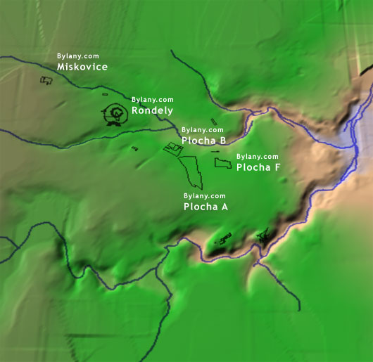

GIS maps

Digitalization of plans and map bases, and consecutive creating of the archaeological GIS system of the Bylany site forms part of the ‘Neolithic settlement ranges archaeology’ project supported by the Grant Agency of the Czech Republic No. 404/03/036.

Neolithic settlement area at Bylany

Lokalita Bylany Bylany.com - Miskovice Bylany.com - Circle enclosures (Bylany4) Bylany.com - Area B Bylany.com - Area F Bylany.com - Area A


© 2004-2005 Mgr. Petr Květina, Copyright | site by JanBartos.net | aktualizováno: 17 March, 2021